Today we celebrate and explain the Montessori puzzle maps. Beautifully and colourfully painted and carefully crafted out of wood, they can be found in both the Pre-Primary (3-6 Years) and Lower Primary (6-9 Years) classrooms. While they are used differently in the two environments, educators take a developmentally appropriate approach to utilising this beautiful geography material.
The Material
In a Montessori classroom, one will find a wooden rack that contains a series of puzzle maps. They are arranged intentionally, starting with the top shelf, and working downward:
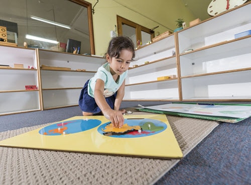
- The planisphere: two blue circles with removable coloured continents
- A map of the child’s continent: puzzle pieces indicate countries
- A map of the child’s country: puzzle pieces indicate states or provinces
- Maps of the other continents of the world: pieces indicating countries
There is typically also a set of control maps, or corresponding laminated paper maps that have the pieces drawn to scale and labelled. Children may use these as reference depending upon the activity.
An Introduction
In the Pre-Primary Program, we begin with the top map of the world. Previously, the child will have worked with the Montessori globes, so they will have some idea about the world, the continents, and the oceans. Using the three-period lesson format, the guide introduces (or reviews) the names of the continents. The guide will demonstrate how to properly retrieve the puzzle, lay it out on a work mat, remove each piece carefully and replace them while naming them. Some classes may have laminated paper labels the child can lay on top of the pieces while they work.
A critical part of the introductory lesson is showing the child how to properly put the puzzle back together and return it to the correct shelf in the rack. Our guides take great care in making sure lessons are not just about the academic skills, but also about how to respect the materials, ensuring they will be in good working order for the next child.
The Work
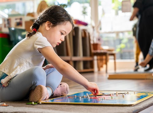
Once the child has been given the introductory lesson, they may return to this work whenever they like. As with everything else in the Montessori environment, if the child continues to feel drawn to a material, they are still getting something out of the experience. This may appear overly repetitive to our adult eyes, but it’s important that we suspend those judgments and allow the child to trust their instincts.
Once the child has tired of the world map, they are welcome to proceed downward through the others. Their teacher does not necessarily need to give a lesson for each one (although they may, for various reasons); once a child understands how to use the puzzle maps, they are free to explore them all.
In the Lower Primary (6-9 Years) Program, we encourage children to use an atlas alongside them while they work. While control maps are useful and serve their purpose, it’s important that they begin to develop their proficiency with a variety of reference tools. When using an atlas, they often need to refer to the table of contents, find the correct page, and look carefully for labels that don’t correspond exactly with the colours and fonts they are used to seeing on the Montessori control maps. This is just one of the many ways we gently guide children toward being able to find answers for themselves.
Extensions
The puzzle maps are such a popular material among children, that it’s only natural we should offer extension work to create more learning experiences for those who are ready and eager. Just a small sampling of the possibilities:
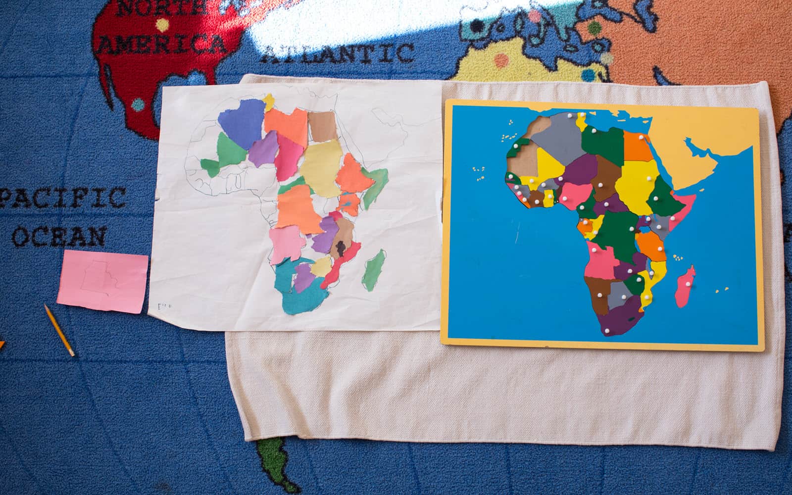
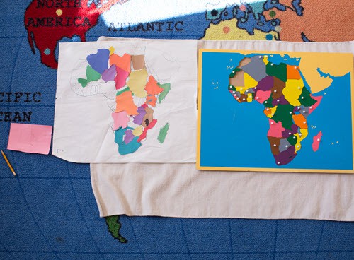
- Pin punching: In the primary classroom, children may trace continent pieces onto construction paper and use the pin punching tool to perforate each one. They may then adhere them to perforated blue spheres, thereby recreating the map so that they may have a copy to keep.
- Map making: Giving children large pieces of white paper, they may carefully trace, label, and colour each individual piece.
- Embark on research projects: Children who have enjoyed and mastered the puzzle maps may then choose to read and write about various continents or countries.
- Continent studies: Some teachers choose one continent each semester to focus on in depth. While the puzzle maps serve as a focal starting point, the study will include exploration of biomes, animals, culture, and more.
What’s Next?
Children love the puzzle maps, so they often spend years absorbing everything they can from them. Eventually, however, they are ready for more. At some point during the lower and upper primary years we introduce the pin maps. These are smaller wooden boards with maps drawn on them, and with three tiny holes drilled into each country: one for the country’s name, flag, and capital city. Corresponding metal pins with labels are available for the child to use as they learn to identify each. Control maps are available for the child’s reference.
As with many other materials, the pin maps are introduced in steps. First, the child will just focus on learning to label each country. Once they have mastered that skill, they will move on to flags, and eventually, the capital cities.
